
The horizon momentarily lined up with the crack in the windshield: an azure sky separated from the razor-sharp profiled mountains of the Chihuahuan desert. Twenty-two hours on the road and it finally hit me. I was in West Texas.
Two weeks earlier, neither the idea of the trip nor the crack in the windshield had existed.
Mid-January in the Piedmont of North Carolina engenders a certain degree of winter malaise. Despite the lack of the colors associated with the southern appalachians, green in spring and summer, the blaze of orange and red in fall, I love getting up high in the mountains in winter and looking down on the rolling, sometimes rugged, terrain of the local hills. But the horizon, consisting of increasingly fine branches of leafless trees dissolving into soft-edged blurs, makes me wonder if I'm finally in need of glasses.
The fireworks of autumn were now a memory, while the earliest blossoms of spring were still two months away. Snow fell in dribs and drabs on the icy trail, an inch overnight reduced to an ugly brown mush by 10 AM the next morning. I had to admit I was yearning for a different horizon, one sharp enough to leave a perfectly reversed image burned on my retina, a fracture across my mind's eye.
I thought first of Bryce Canyon National Park in eastern Utah. The brilliant red stone hoodoo canyons capped in snow would be an obvious start for a contrasting horizon. I had been there in the winter before, hiking the Under The Rim trail in the snow in the mid-'90s. But it had been four years since I'd last leaned on my map and compass skills for a multi-day trip, and I wasn't certain they were up to par. Besides, at 45, I questioned my ability to manage a 30-hour road trip there and another one back after three days of hiking. The "Water Bottle Trick", used to minimize restroom breaks, seemed less a proof a masculinity and more a likelyhood of a hefty upholstry cleaning bill.

Scanning the map for something a little closer, my eyes rested for a moment on Carlsbad Caverns, piquing memories of childhood, sweltering road trips to the Southwest, and the chill air in the great room of the cavern. Beautiful, but not a hiking destination. Then I noticed an outline of green just across the state line into Texas. Only 35 miles from Carlsbad Caverns was Guadalupe Mountains National Park. I recalled reading somewhere that it held the highest point in Texas, Guadalupe Peak, at 8,751 feet, but that was the extent of my knowledge. An extensive network of trails would give me the opportunity to explore the Chihuahuan desert, the second-largest in North America. Perfect.
The timer started: one week to plan and then on the road. As a Hail Mary, I emailed my usual adventure buddy, Gary Sizer,and asked if he could come along. He had finished the Appalachian Trail in October, was writing a book about it, and trying to find a job and reintegrate into the workaday lifestyle. I of course, was trying my damnedest to forestall that. I sent him an email.
"If you're up for a completely random, quixotic, and rapidly approaching adventure, I'm driving 1,500 miles next weekend to visit one of the least-known national parks in winter. It's insane, so you were the first person I thought of. There are campsites a mile from the highest peak in Texas at almost 9,000 feet, and I'd get to check off another national park visited. It'll be about 24 hours of driving for three days onsite and then 24 hours back. The park might be shite and I have no idea about weather. We could be eaten by mountain lions or bored out of our minds. You in?"
Gary responded that the timing was wrong, that he was jealous, and that he wished me the best. Ah, well. Then I started getting anxious. I was going to just get up and go in a week? Was I crazy? What if the car broke down? What about my wife? What if something happened to the house while I was gone?
These were not the sort of thoughts that occurred to me when I was a young man. In the '90s I took things in stride. Fuel pump fails descending into Lone Pine, California, in the middle of the Sierra Nevadas, with no replacement available for two days? What an awesome opportunity to visit those rocks that were in just about every B movie Western! Wander the town, find a dive bar, and see what happens. Bend, don't break. But 20 years of attempting adult responsibility had made me a contingency planner. If it was just going to stress me out, why the hell was I going? I started to doubt the whole endeavor.
When I got up the following morning, a crack had mysteriously appeared in the windshield of my Subaru Outback. The metaphor wasn't lost on me. The internal war of attrition between the free spirit who craved new experiences and the cautious man I had become continued for a couple of days, until a phone call brought détente. "I got a job and it doesn't start until March," Gary said. "I'm in!" My partner in crime had come through. The next three days went by in a blur of packing, unpacking, repacking, and car maintenance.

Driving across country can be tedious beyond belief when you're not stopping for anything but gas and restrooms. FM radio was once all the stimulation I required on the open road. Now apparently I need podcasts, clever playlists of music from prior decades thoughtfully and somewhat sadistically compiled by Gary's wife Katie, and a GPS that shows an X-wing flying along the interstate as a proxy for our current location. You've come a long way, baby. Now get off my lawn.
Driving around south of Witchita Falls, Texas looking for a cheap motel after 15 hours on the road, we determined that the city planners must have decided no one in their right mind would ever drive south out of Witchita Falls. We ended up in the only motel for 60 miles that didn't require turning around and backtracking. It was in a town called Newcastle and it reminded Gary of many of the hiker hotels along the AT. What it lacked in amenities it made up in proximity to a convenience store. After settling in, Gary went out to buy some beer. He came back with a six-pack of Heineken, and we chuckled at the incongruity of drinking it in Newcastle.
Lack of sleep and angst began to catch up, sending my mind into contingency planning and costing me more sleep. I lived at 800 feet above sea level and had done zero hiking above 4,000 feet in weeks. Within two days, I would be above 8,000 feet, climbing over 1,000 feet per mile and carrying all the water we needed for the backcountry. By morning I became resigned that there was nothing I could do about it now.
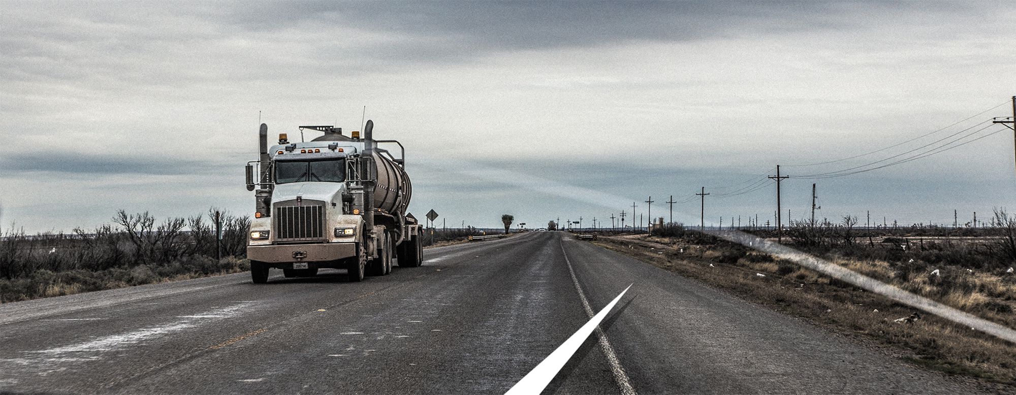
Shoulder? Lane? Industrial refuse site? Taxidermy collection zone? The broad flat shoulders of two lane in roads in West Texas are used for all of the above. Polite, but unwilling to slow down, West Texas drivers add a mix of Mad Max aggression and “Aw shucks ” civility to any road trip.
The drive through west Texas was a revelation for Gary. We had driven across southern Iceland together the previous March, but it was the Texas two-lane roads with 70 m.p.h. speed limits that baffled him. Not the speed limit, or the two-lane aspect, but rather the practice of veering onto the shoulder to let faster vehicles pass. My wife is a native Texan and as such I had gotten accustomed to the local driving norms. The shoulders are wide and flat, but they also are in the middle of scrub desert full of of oil wells, refineries, and other industries that rely heavily on metal. As you attempt to pass someone who has helpfully edged over onto the shoulder to give you room, but is still driving at full speed, you must navigate a garbage cloud of dust, gravel, scrap metal, and the occasional coyote roadkill thrown back onto the roadway. In Gary's defense, he adapted rapidly and was soon flying through clouds of dust and debris that belonged in a Michael Bay movie.
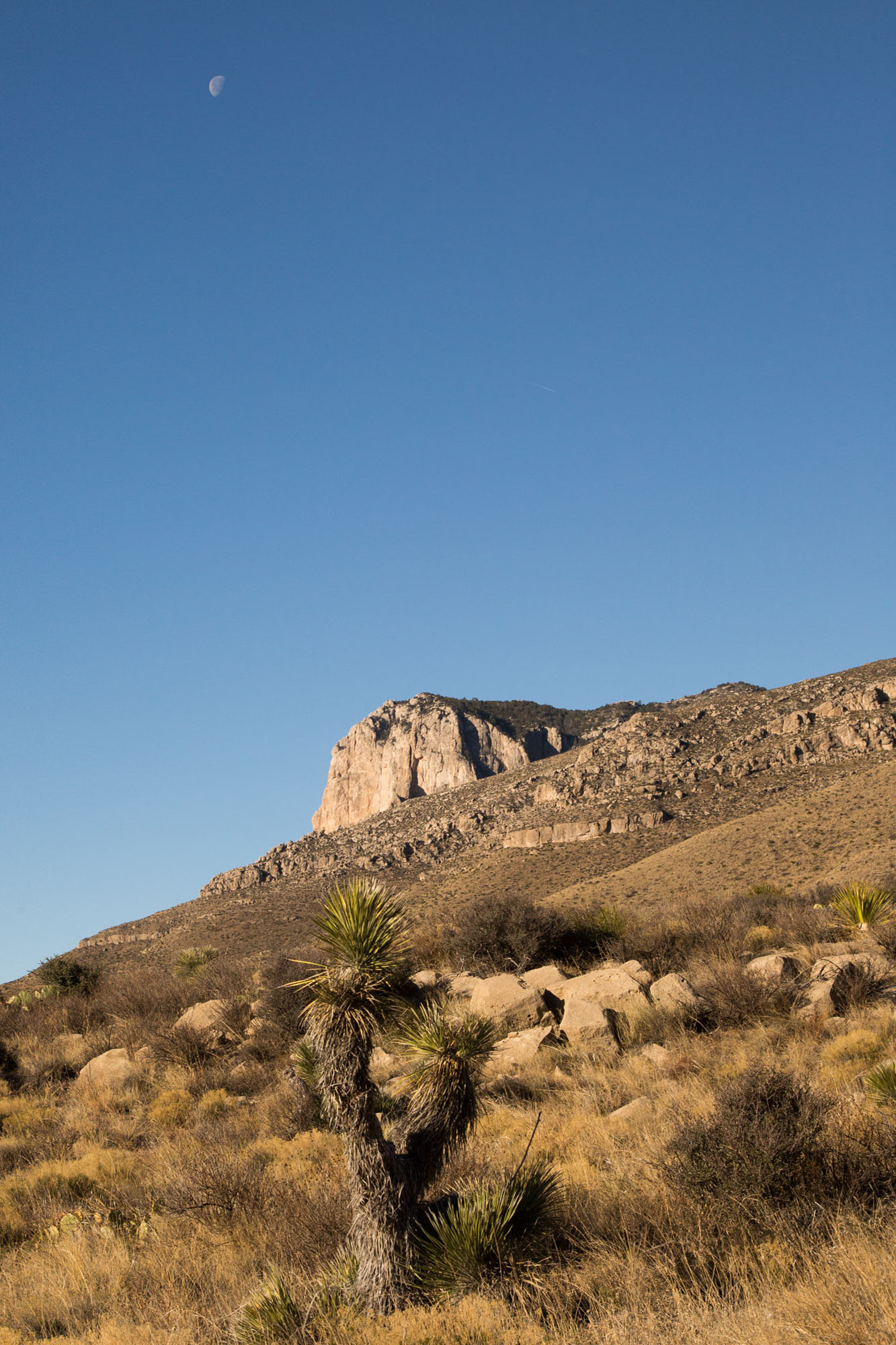
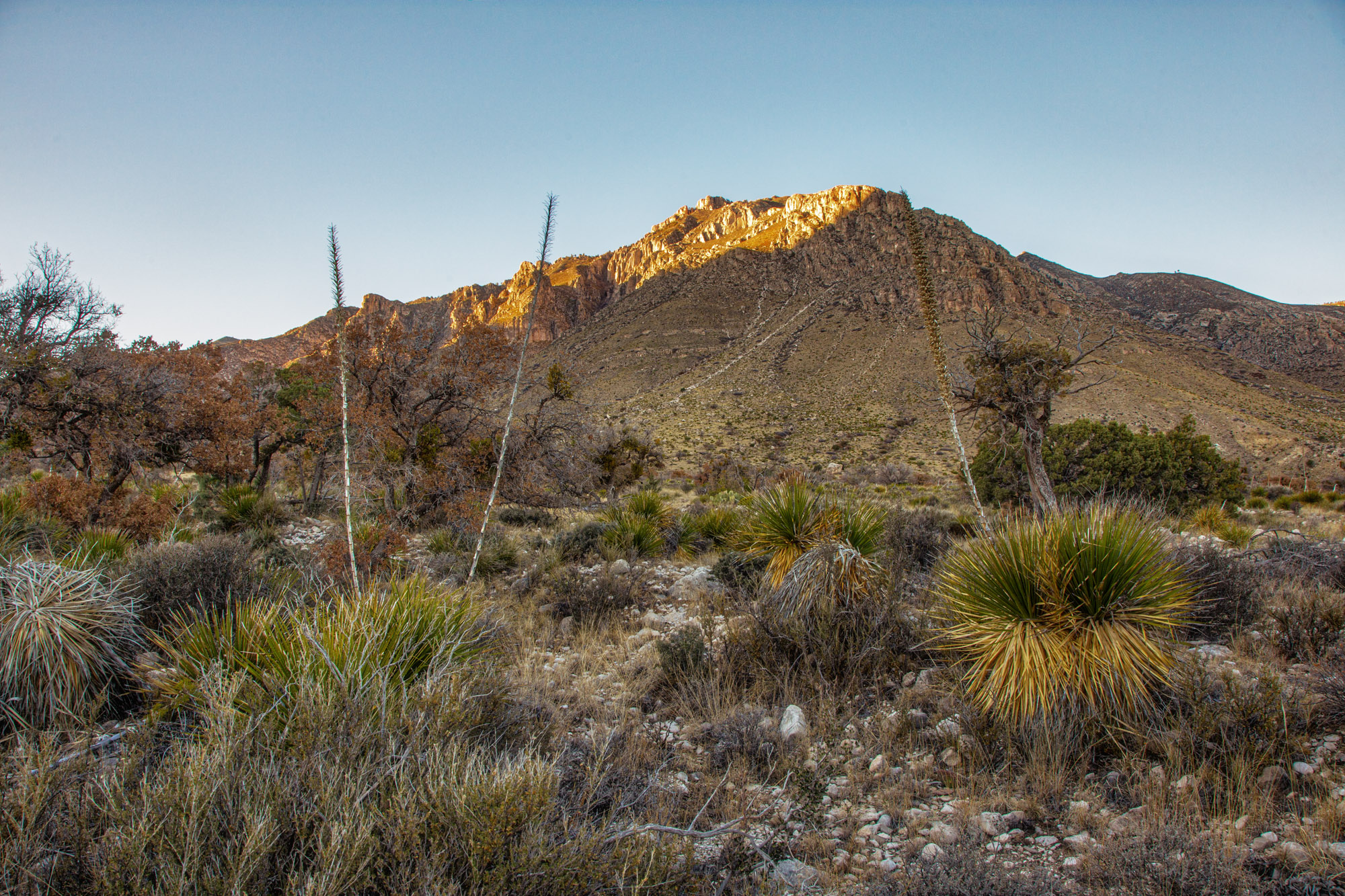
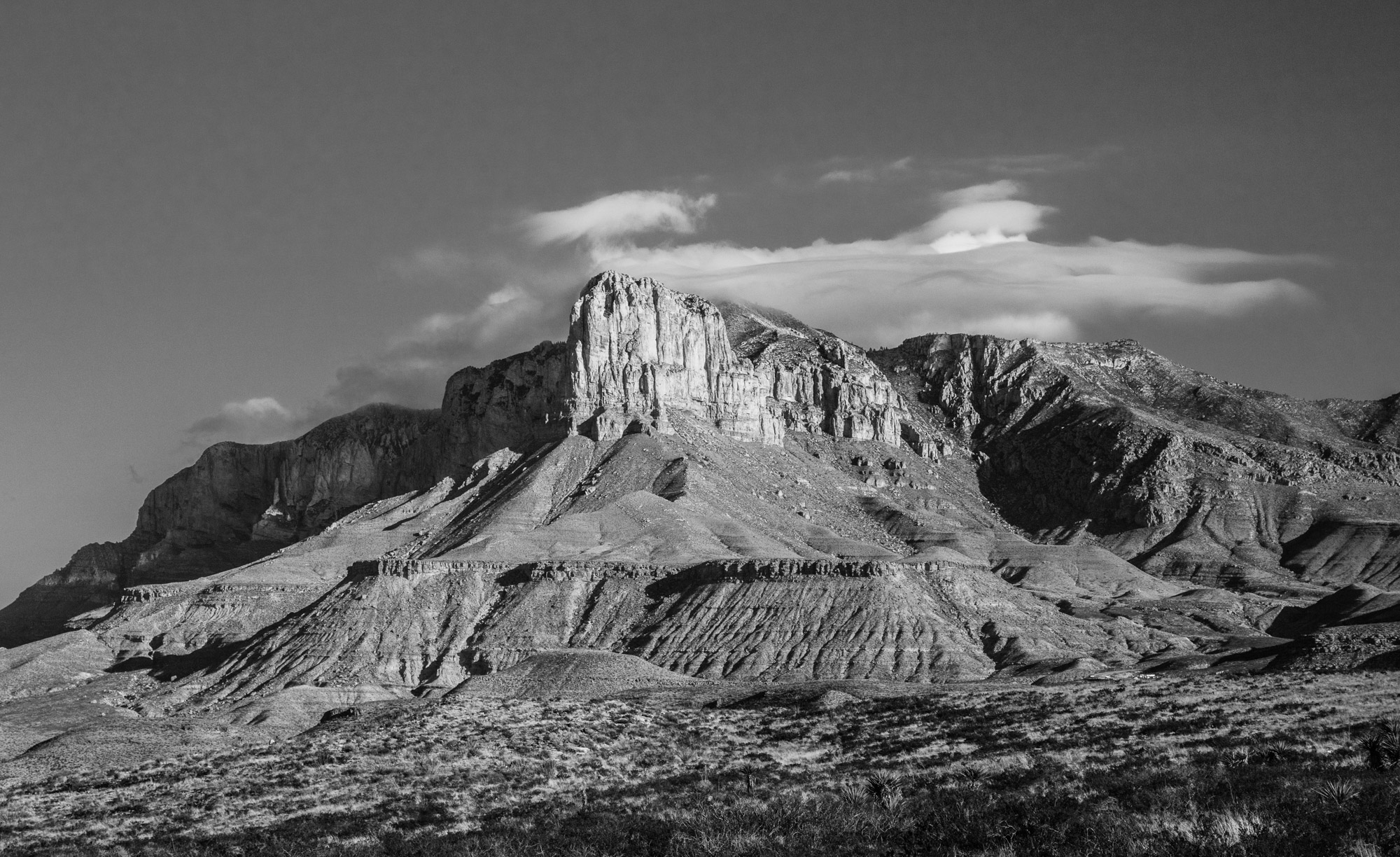
We pulled into the park just after the visitor center closed but before sunset. The approach from Carlsbad led us from flat scrub up through the foothills of the Guadalupe Mountains, and as we rounded a bend, the rock formation called El Capitan came into view. While Guadalupe Peak is the highest in Texas, the sheer thousand-foot face of El Capitan is the feature that dominates the park, looming over the El Paso Salt Flats.
As the last traces of sunlight bounced off Hunter Peak, we set up our tents. We cooked by headlamp under an amazingly clear field of stars, and when we turned in, I finally felt like things were going to be all right.
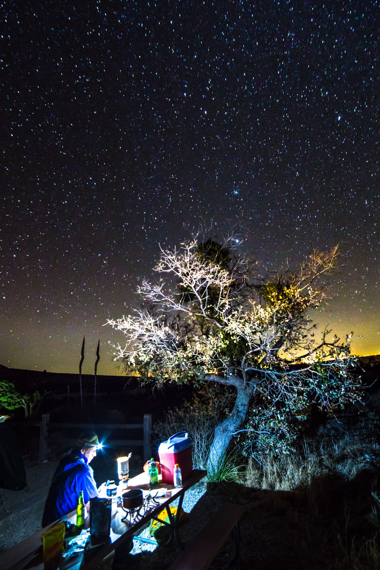
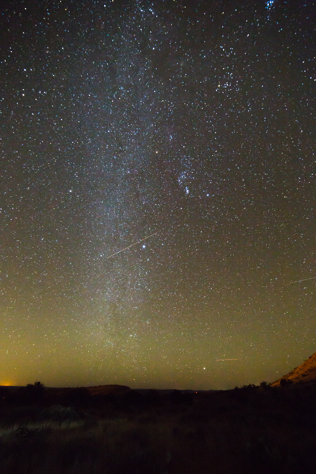
• Dinner by starlight
• Moonset over El Capitan
• West Texas Milky Way
• Sunset over Hunter Peak
Dawn broke, and I felt rough—head aching, heart pounding, stomach churning, and a bladder wanting to be emptied every 15 minutes. Hardly ideal for hiking in the desert. Our plan to climb the steepest trail in the park and camp at 7,700 feet at the McKittrick campsite wasn't going to happen. I broke it to Gary. "Uhh, dude, we might have a problem."
Goal reassessment is standard operating procedure for me, since I often bite off more than I can chew. For me, the accomplishment of a goal is secondary to being there. Even if a summit isn't achieved, or a mileage goal is unattained, I still have the experience. For this reason, it's often better for me to take trips alone. Group dynamics are fickle things, and finding the right partners can be a challenge.
Fortunately for me, Gary is used to my variable nature, and having just completed the Appalachian Trail, he still held to the mantra of "hike your own hike." We decided to do the Guadalupe Peak trail as a day hike rather than an overnight. That would save us not only the weight of camping gear, but about 10 pounds of water apiece, since the campsite a half mile from the summit was completely dry.
Given how I was feeling, I knew my chances of making the top were kind of slim, but I was here, dammit. And it would be an experience regardless. I loaded up the tripod and camera gear, along with my three liters of water and 10 essentials, and braced myself for a struggle.
We got a late start due to the logistics of obtaining permits and fine-tuning packs. The hike climbed steeply from the very beginning, starting at 5,800 feet and rising over the next four and a half miles to the summit at 8,749. Gary started off strong with me following behind. A couple from Colorado started with us and kept just ahead. After the first mile and just under 1,000 feet of gain, I turned to Gary and admitted, "I'm so not feeling it, man."
And so it went. Every few hundred yards I'd think of turning back. My legs were feeling weak already, making cramping a real possibility on the way back down. By the time we finally reached the top of the first of a seemingly endless series of switchbacks, Gary and the Colorado couple were about 300 yards ahead of me. A man passed me, descending. "Hey, the hard part is over. Keep going!" he said. Gary called down from the switchback above me, "Hey, that guy says the rough part is over!" I paused. "Hey, did you hear me?" Gary reiterated. "He said the hard part is over!"
"I'm trying to decide how much I care!" I yelled back. The Colorado couple laughed.
With a mixture of resignation and relief, I told Gary that I was now aiming for the campsite only, and wouldn't make the summit. The view of El Capitan from Guadalupe Peak would be denied me. I'd climbed much higher, longer, and steeper trails, but on this day my endurance and will stopped 600 feet and half a mile from the summit. Gary and I parted ways at the trail juncture for the campsite, and I turned around. Part of me had cracked.


• Switchbacks one
• Carved into the rock
• Final set of switchbacks before returning to the trailhead
The views of Hunter Peak opened up across the valley as I hiked back down. They had always been there, but in the myopia of ascent I had focused only on the 10 feet of trail ahead of me. Any sense of expediency fell away. I hiked slowly, looking at the trail I had just climbed up, a zigzagging hairline leading from the horizon to my dust-covered boots.
This was what I had come to see. My beloved Appalachians hide their trails like cherished treasures. Even above the treeline on the balds, mountain laurel and tall grasses conceal them, along with a soft atmospheric haze. Here, they stand in sharp relief. My body was unhappy, but my spirit was content.
About two and a half miles down, my body got tired of playing second fiddle to my spirit and threw a temper tantrum. My left thigh clenched, locking my leg out straight. I grunted and limped to the end of a switchback, where I dumped my gear and plopped down on my ass. With detachment, I watched the muscle twitch under the thick fabric of my pants. Any doubts I'd had about turning around were immediately eased. Had I kept going, I would have gone from a tired hiking companion to a possible liability to those around me. Rule one: A hiker should be responsible for himself in the wilderness, understand his limits, and expect help from no one.
I made it back to the campground without anymore mishaps. The late afternoon sun felt much warmer than the thermometer would indicate. I had gotten a bit dehydrated despite careful attention to water intake, so I spent the rest of the day drinking water and musing.


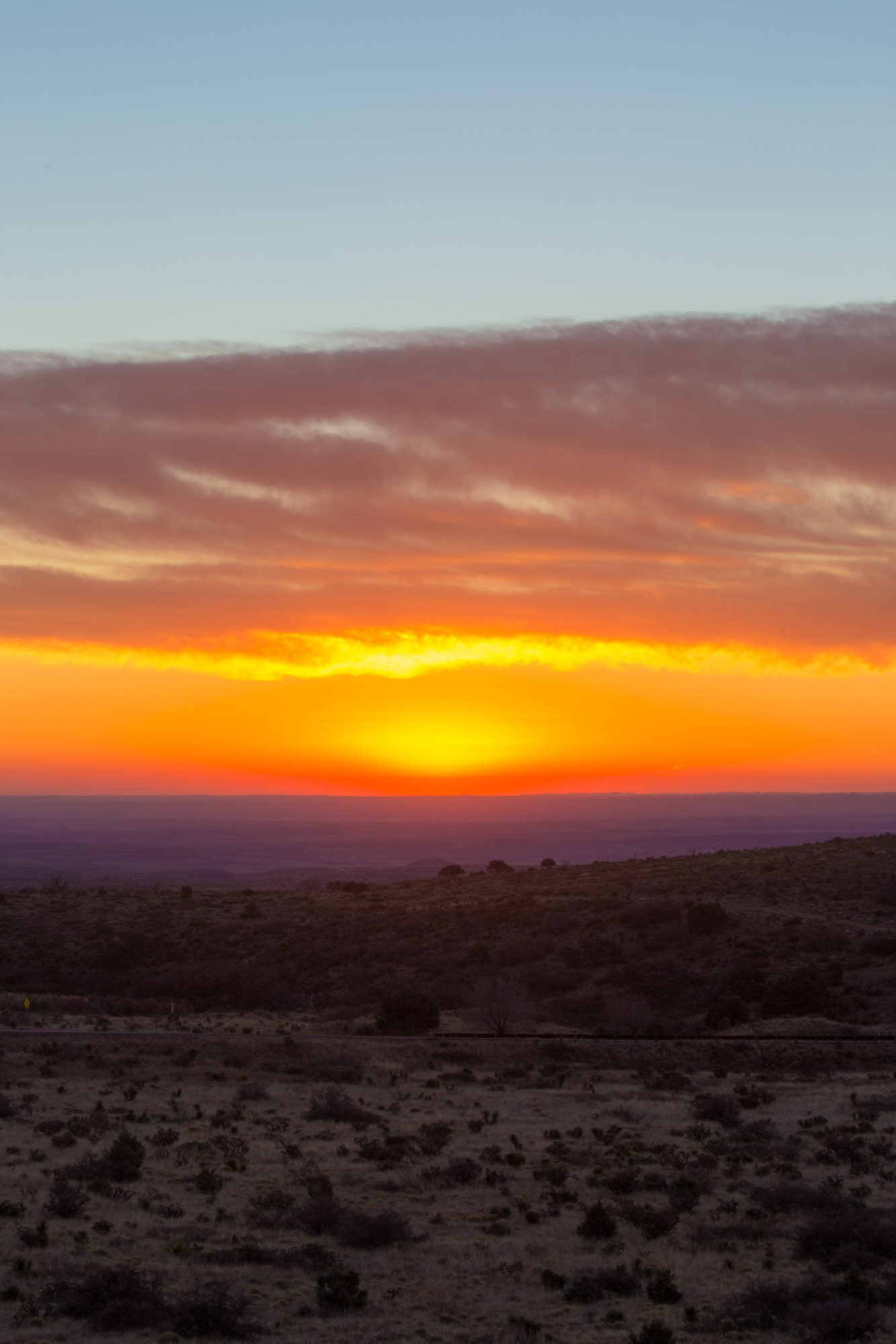
• Mesquite sunrise
• Razor Horizon
After Gary arrived, we discussed plans for the following day. We decided to keep it simple and just attempt a day hike the next morning. It seemed a bit of a letdown, and our gear was definitely better suited to backpacking than car camping, but there it was. I went to my tent for the night with trepidation. What if I woke up feeling like crap again? Three thousand miles of driving for an aborted attempt on a mid-altitude summit? I slumped into a bout of self-pity and slowly fell asleep. I awoke to a smattering of clouds above the approaching dawn.
Letting Gary sleep, I broke out the tripod and camera, climbed a small rise a few hundred yards from our tents, and watched the sun paint an inverted cone of orange and yellow in the pink and purple sky from below the horizon. As it finally found a break in the low-lying clouds, it suffused the entire landscape with an orange light. As I concentrated on the sunrise, I caught a bit of movement out of the corner of my eye.
Something that isn't mentioned very often in the photography literature is the "wrong lens fumble," which occurs when you are shooting a subject with one type of lens and an opportunity appears for another photograph that requires an entirely different lens and settings. The camera was set up with a wide angle lens on a tripod. If I tried to take a photo of the deer now, they would appear as tiny red orange dots on a red orange background. So I did the wrong lens fumble, hoping the deer wouldn't bolt. Dexterity seems to leave me in those moments. I dropped a filter. "Aw, shit." A lens cap rolled down through the brush. "Shit!" The deer bolted across the landscape, their bounding movements so alien compared to those smoother gaits of the white-tailed deer so common in the East.
And then, amazingly, they stopped. "Well... shoot."
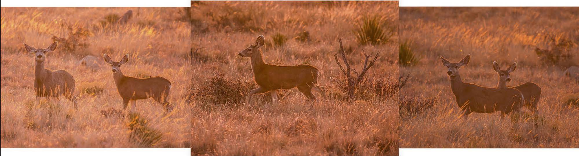
The low sun created perfect halos around a doe and her nearly full-grown fawn. The doe eyed me with suspicion, the fawn with curiosity. As they watched, I finished my lens change and quickly snapped off a few shots before they turned and bounded out of range. My self-pity erased itself in that moment. Mule deer are as common in the West as white-tailed are in the East, but this encounter was exactly what I needed.
As Gary and I made breakfast, we decided on the El Capitan and Salt Basin Overlook trails, an eleven-and-a-half-mile loop. The weather was supposed to be a bit variable, and by variable I mean schizophrenic. Temps in the upper 60s in the morning and 30s by late afternoon, with the wind rising to a sustained 30 m.p.h. with gusts in the 50-60 m.p.h. range. A perfect day for a hike.
The trail wound around the base of El Capitan and ended at an overlook above the El Paso Salt Flats. We set out by 8:30, the path winding, constantly rising and falling as it dove down into dry washes and traversed the loose limestone talus slopes of the surrounding stratified cliffs. The imposing edifice of El Capitan was our touchstone, sometimes almost completely obstructed by intervening ridges, sometimes looming, blotting out the sky. Red-tailed hawks rode the increasing drafts growing up the stone faces.


• A dry wash, or arroyo, if you're 40 miles away in New Mexico
• Gary and agave
• Storm rising over El Capitan


• The El Paso Salt Flats
• Gary on top of the unnamed peak
• Fallen pillars
• Monolith and rising clouds
The longer I hiked, the happier I was. My body didn't necessarily feel much better, I just cared about that less, achieving the hiking rhythm that had eluded me the day before. We made a short side trip to an unnamed summit looking down over the official Salt Basin Overlook and ate lunch, with the mass of El Capitan to one side, the salt flats to the other.
The last few miles of the hike were much more challenging. The trail disappeared where a flood had come rushing down a wash, so we spent a while bushwhacking through a dry riverbed, up and over boulders and embankments. It looked as though the trail might cross the wash several more times, and while getting back home was never in doubt, it would definitely take longer if we were forced to bushwhack the entire way. "Every plant here wants to stab you," Gary observed. Pants were poor protection from the needles, pins, and daggers that constituted the local flora. So we walked back up the wash, where water had scraped away the desert soil down to the limestone bedrock. Once we attained a high point, the open spaces helped us find the trail again.

Head down, feet up. An old cistern is just one of a number of reminders that there were communities here before the park.
(Photo by Gary Sizer)
The Captain and his cap
By now the wind was howling, nearly knocking us over every time we came to an exposed place. Standing in the wind, we watched the clouds blow in to slowly cloak the tops of the mountains. Whitman's "barbaric yawp over the roofs of the world" came from my mouth, unbidden. Yelling into a gale is cathartic—an answer for both self-doubt and self-aggrandizement, helplessness and arrogance. It makes not a whit of difference to the wind, and that's the point. "I feel good," I told Gary. "Yeah, I could tell," he said. "I was afraid to say anything, in case it would remind you that you were supposed to be feeling like crap."
When we made it back to camp, Gary admitted he was worried about getting back to North Carolina in good enough condition to meet his new employers on Monday even though the job didn’t start for a while. Honestly, one more hike was not going to top today's, as far as I was concerned. Reluctantly, we called our trip one day early. It hadn't gone the way I had planned, but what were the plans anyway? I wanted to taste desert dust. I wanted to experience a place that was new to me. I wanted horizons and the chance to run my hands along the leaves of the agave.
It's easy to get caught up in the metrics of a trip just like everyone else: miles, altitude, fitness, pack weight. They can often drive us on, force the best out of us when we think we can't go any further. Comparatives and superlatives spur us forward in our day-to-day life too. Only by stretching our limits do we find out what we are capable of. But transcending our limits is only part of exploration. It can block out the view of discovery beyond our abilities. When our expectations sometimes loom too large, the only way to really enjoy exploring and discovery is when our hopes fail, and we can see the natural world through the cracks in our expectations.